Geospatial • Full-Stack • Climate Tech

Building elegant digital systems from maps, data, and product thinking.

I’m Ashly W Ochwada, a developer with experience across geospatial engineering, full-stack product development, AI-assisted workflows, backend APIs, and user-centered design. I enjoy turning complex data into platforms people can actually use.

  • 5+ roles across software, GIS, UX and AI
  • 3 regions of professional collaboration
  • 1 builder mindset
Stylized profile card for Ashly Walala Ochwada
Core zones Geospatial Platforms Climate Data Product Design Backend APIs AI Workflows

From map-heavy systems to polished product experiences.

Abstract illustration representing geospatial dashboards and product design

My work sits at the intersection of software engineering, geospatial analysis, climate-tech, UI/UX design, and data visualization. I care about building systems that are useful, scalable, and clear, even when the underlying data is messy and complex.

I’ve contributed to interactive geospatial platforms, environmental decision-support tools, backend services, AI workflows, and mobile-connected systems. I like shipping things that feel thoughtful, not just functional.

System Design Spatial Analytics API Engineering UX Research Cloud Deployment

Professional journey

Roles that sharpened my stack across software engineering, geospatial systems, AI, UX research, and climate-tech product development.

Oct 2025 — Mar 2026

Fullstack (Geospatial) Web Developer — Consultant

Space4Good · The Hague, Netherlands

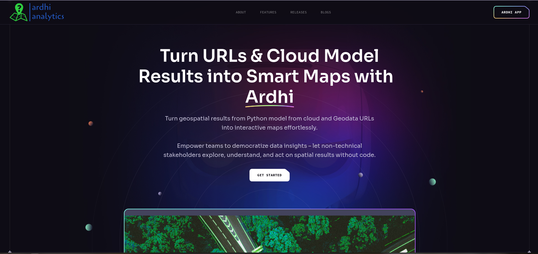
  • Developed interactive geospatial web platforms using Svelte, MapLibre GL, and Deck.gl to support climate risk assessment and environmental decision-making.
  • Integrated satellite imagery and Cloud Optimized GeoTIFF datasets through TiTiler and tile services for high-performance spatial visualization.
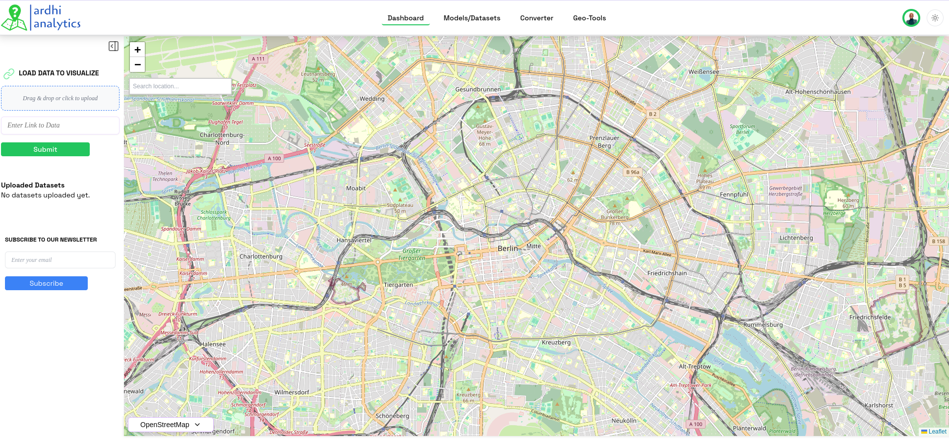
  • Built analytical dashboards using custom UI components, filters, AOI selectors, and legends to improve user-driven exploration of environmental data.
  • Implemented cloud-based data pipelines with Azure Blob Storage and automated manifest generation to streamline dataset discovery and access.
  • Developed lightweight backend services using Node.js and serverless patterns to deliver geospatial analytics efficiently.
  • Implemented spatial modeling features using spectral indices, aggregation logic, and classification thresholds to support biodiversity and carbon risk analysis.
  • Contributed to EU-funded digital platform deliverables through technical documentation and architectural descriptions.
  • Collaborated with scientists, designers, and engineers in agile workflows to translate research requirements into production-ready systems.
  • Optimized rendering performance and debugging workflows using profiling tools and testing practices to support scalable deployments.
Sep 2024 — Jun 2025

Fullstack Software Developer

Ardhi Analytics · Berlin, Germany

  • Developed and maintained a full-stack geospatial platform, integrating frontend and backend systems for seamless user interaction and data management.
  • Designed and implemented an interactive frontend with React, enabling users to visualize, analyze, and interpret large geospatial datasets effectively.
  • Built and optimized REST APIs and WebSocket connections using Django and Node.js to support smooth data exchange and real-time updates.
  • Integrated Leaflet, OpenLayers, and Mapbox to improve the rendering and performance of high-resolution spatial data.
  • Developed backend logic for processing geospatial data and supporting formats such as GeoTIFF, CSV, and GeoJSON for export and interaction.
  • Optimized application performance through frontend best practices, database indexing, and caching strategies.
  • Implemented authentication and user management using Clerk to strengthen access control and data integrity.
  • Conducted code reviews, unit testing, and debugging across the stack to improve maintainability, performance, and security.
Sep 2024 — Jan 2025

UI/UX Designer / UX Researcher

Ardhi Analytics · Berlin, Germany

  • Designed an intuitive web platform for spatial data visualization and analytics, improving accessibility and usability for researchers and decision-makers.
  • Led UX research through interviews, surveys, and usability testing to identify pain points and improve interaction workflows.
  • Translated research findings into clearer user journeys, more intuitive layouts, and stronger product decisions across the platform experience.
Dec 2023 — Feb 2024

AI Operator

CODX · Spain (Remote)

  • Monitored AI-driven applications to maintain strong performance and improve efficiency in automated decision-making workflows.
  • Assisted in training deep learning models using TensorFlow and PyTorch for image classification and anomaly detection tasks.
  • Handled data preprocessing, cleaning, and augmentation to improve training quality and prediction accuracy.
  • Worked on real-time AI applications, optimizing inference speed through GPU acceleration and model compression techniques.
  • Implemented AI-based automation processes that reduced manual workload and increased operational productivity.
  • Researched AI and machine learning advancements to support improvements in model efficiency and accuracy.
  • Maintained detailed documentation for models, datasets, and benchmarks to improve reproducibility and team collaboration.
Jun 2023 — Jul 2024

Junior Fullstack Software Developer

Carble · Utrecht, Netherlands

  • Developed and maintained interactive dashboards using React to visualize Scope 3 carbon emissions and deforestation risks for stakeholder monitoring.
  • Built backend APIs with Python and PostgreSQL, integrating real-time deforestation data from satellite imagery and geospatial analysis models.
  • Worked with remote sensing technologies to extract insights from satellite imagery and improve the accuracy of carbon modeling and deforestation tracking.
  • Optimized database queries and geospatial computations to support efficient processing of supply chain emissions data for reporting and compliance.
  • Developed compliance monitoring tools to help clients align with the EU Deforestation Regulation and track supply chain sustainability.
  • Integrated machine learning models for predictive analysis, enabling future carbon reduction projections and climate action planning support.
  • Designed and implemented reward mechanisms that incentivized deforestation-free supply chains and supported sustainable farming practices.
  • Automated pipelines for geospatial and climate data processing, improving reporting accuracy and reducing manual workload.
  • Collaborated directly with the CTO to define technical strategies and support the integration of sustainability-focused product features.

Selected work

Real-world builds and personal systems showcasing execution, design thinking, and full-stack capability.

Loan Eligibility Prediction Model

A machine learning project focused on predicting whether a loan application is approved or rejected based on applicant financial and demographic data. The model was built using structured datasets, with emphasis on data preprocessing, feature selection, and classification.

View Source Code →

Kaileys Consortium Mobile App

Developed and deployed a mobile-connected platform for Kaileys Consortium, enabling users to interact with business services through a seamless digital experience. The system includes backend APIs, secure authentication, and optimized data handling to support real-world usage.

Live on Google Play Store

View on Play Store →

Geospatial Analytics Dashboards

Designed and built interactive geospatial dashboards for environmental monitoring and decision support, enabling users to explore complex spatial datasets through intuitive, map-based interfaces.

Focused on transforming satellite and environmental data into clear, actionable insights for real-world use.

Ardhi WebGIS Platform

Contributed to the development of an interactive WebGIS platform enabling users to upload, visualize, and analyze geospatial datasets through a dynamic map-based interface.

Focused on data ingestion, real-time visualization, and intuitive spatial exploration workflows.

AgroMarket Platform

Designed and developed a digital marketplace connecting farmers, merchants, and consumers, enabling seamless discovery and direct purchase of fresh agricultural products.

Focused on intuitive user journeys, category-based filtering, and scalable UI architecture for a modern agri-commerce experience.

Core toolkit

Frontend

React, Next.js, Svelte, JavaScript, TypeScript, HTML5, CSS3, Tailwind CSS, Bootstrap, Redux, Framer Motion, D3.js

Backend

Django, Express.js, Node.js, FastAPI, Firebase, REST APIs, GraphQL, WebSockets, JWT, OAuth2, Celery, Redis

Geospatial & Data

Mapbox, Leaflet, OpenLayers, GeoTIFF, GeoJSON, Shapefiles, GDAL, Rasterio, remote sensing, spatial analysis, Tableau, Pandas, NumPy

AI & ML

TensorFlow, PyTorch, Scikit-learn, MLflow, predictive analytics, computer vision, image classification, anomaly detection

Cloud & DevOps

AWS, GCP, DigitalOcean, Docker, Kubernetes, Nginx, Terraform, CI/CD pipelines, GitHub Actions, GitLab CI/CD

Design & Product

Figma, Adobe XD, Photoshop, Illustrator, design systems, usability testing, A/B testing, user-centered design

Let’s build something impactful.

Open to software, geospatial, climate-tech, product, and data-driven opportunities. Reach out for collaborations, consulting, or neat problem-solving chaos with a polished finish.

Abstract contact illustration